From Basin Tensions to Local Realities: A Pragmatic Roadmap for Water and Climate Resilience in the Tigris–Euphrates


The Tigris–Euphrates isn’t just a river system; it’s a pressure map. Climate stress squeezes from above, politics pulls from the sides, and everyday life (drinking water, crops, and electricity) gets caught in the vise. This piece distills a multiscale assessment we prepared for Première Urgence Internationale (PUI), linking regional geopolitics to practical, local priorities in Iraq and Syria, and turning analysis into an action sequence donors and implementers can actually use.
Why this basin, why now
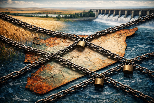
Four countries share the basin (Türkiye, Iran, Iraq, and Syria) and they do so under rising heat, erratic rainfall, and fragmented governance. River regulation and unilateral projects have contributed to reduced downstream inflows in key periods, while the absence of robust basin-wide coordination leaves Syria and Iraq exposed to volatile, uncertain supply. The result is a system where scarcity is manufactured as much by institutions as by climate.
A multiscale lens that connects maps, motives, and voices
To cut through complexity, we integrated three ingredients: (1) territorial diagnostics to reveal spatial patterns like drought exposure and groundwater salinity; (2) geopolitical reasoning to map authority, incentives, and coordination failures; and (3) stakeholder consultations to ground findings in operational reality. The output is not just a report—it’s a sequenced roadmap that starts with quick wins and moves toward harder reforms and cooperation. The same template can travel to other fragile basins facing climate stress and institutional fragmentation.
What the data and dialogues show
1) Fragmented flows, frayed cooperation
Episodes of steep Euphrates inflow reductions, linked to river regulation and management choices alongside climate variability, have sharpened downstream risk. Bilateral arrangements remain partial and weakly enforced, so seasonal volatility hits hardest where institutional resilience is already thin. In short: the hydrology is political, and the politics are hydrological.
2) National stress, different flavors
Syria: Renewable water availability has plunged—well below the 1,000 m³ per-person scarcity line—while climate change tightens the squeeze. Fourteen years of conflict have damaged treatment plants, pumping stations, and networks; in some schemes, as much as half or more of infrastructure is non-functional. Over-extraction has pushed most basins into deficit; lakes and reservoirs shrink while contamination spreads. Agriculture, the biggest water user, still leans on inefficient flood irrigation; drip adoption is minimal. As a downstream state, Syria’s room for maneuver is further narrowed by cross-border politics and outdated accords. The human fallout is immediate: sporadic supply, disease risk (including cholera), and food insecurity.
Iraq: Since the 1980s, total river flows have trended downward while aquifers are being mined faster than they recharge. Aging dams, leaky canals, and low irrigation efficiency waste precious water; pollution loads compound scarcity, as seen in Basra’s 2018 public-health crisis. Per-capita availability could fall below scarcity thresholds in coming decades, amplifying displacement pressures—especially in the south. Political friction between federal and regional authorities complicates unified strategy, making it hard to modernize allocation, monitoring, and demand management at the speed the climate demands.
Two hotspots, two faces of risk
Deir ez-Zor (Syria): Low river levels and power shortages combine into a nasty feedback loop: less flow means less hydropower, which means less energy for pumping and treatment, which means degraded services. Around 60% of people are pushed toward unsafe alternative sources like unregulated wells and trucked water, heightening disease risk. Here, the public-health edge of water insecurity is painfully visible—and fixable through targeted rehabilitation.
Kurdistan Region of Iraq (KRI): The crisis is subterranean. In less than two decades, groundwater levels in parts of Erbil have fallen from roughly 120 m to around 330 m due to thousands of wells serving booming urban and peri-urban demand. Add displaced populations and weak licensing/metering, and you get a classic tragedy of the commons. The clock is ticking: governance must catch up to hydro-reality.
The action sequence: stabilize → consolidate → cooperate
You can’t reform a system that’s flatlining. First stabilize the vital signs, then rebuild the organs, then teach the system to coordinate with its neighbors.
Near term, keep the system alive.
Rehabilitate critical assets: treatment plants, pumping stations, irrigation control nodes. Where viable, introduce solar pumping and targeted wastewater reuse to lower operating costs and reduce outage risk. Additionally, capture the rain, promote rainwater harvesting, and recharge our future. This phase is about minimizing humanitarian leakage and buying time for governance upgrades.
Medium term, fix the steering.
Clarify mandates, reactivate monitoring, and empower water-user associations. Pair that with crop shifts toward drought-resilient varieties and a managed phase-down of flood irrigation, bundling incentives with reliable services so farmers have real alternatives.
Over time, practice cooperation; don’t just preach it.
Start small and seasonal: data exchange on reservoir levels and releases, joint drought bulletins, and test windows for coordinated operations during critical months. These pragmatic steps lower political cost while building trust muscle memory.
What this looks like on the ground
- Deir ez-Zor triage: Rehabilitate priority pumping/treatment nodes linked to cholera risk; formalize safe trucking with interim quality checks while networks recover; pilot solar pumping and safe reuse where feasible to cut operating costs and stabilize supply. These are fast moves with high health return.
- KRI groundwater guardrails: Register and meter wells, introduce tiered abstraction fees, and combine enforcement with support for on-farm efficiency and crop shifts. Pair emergency services for displaced groups with sub-basin monitoring so depletion trends are visible and actionable.
Three takeaways for decision-makers
- Scarcity is geopolitical and institutional, not just technical. If agreements are weak and mandates are blurred, even a “good” water year can deliver bad outcomes.
- Multiscale analysis turns into policy sequencing. When maps (where), motives (who/why), and voices (how it works on Tuesday afternoon) are braided together, you can stage interventions that actually stick.
- Replicability matters. The same engine—territorial diagnostics + geopolitics + consultations → prioritized entry points—can be adapted to other fragile basins where climate stress meets institutional fragmentation. Think of it as a method kit rather than a one-off report.
Closing thought
Rivers do not respect borders, but cholera does not respect patience either. In the Tigris–Euphrates, stabilizing essential services is the ethical floor; building governance that can manage scarcity is the strategic ceiling; and practicing cooperation, even in small seasonal doses, is the bridge between them. When we connect basin tensions to local realities—and sequence action accordingly—we shift from crisis reaction to resilience by design.
This post condenses and reflects our contribution co-authored with Darío Salinas Palacios (Cassini Group / French Institute of Geopolitics) with the support of Blue Peace Middle East and INWRDAM, prepared for Première Urgence Internationale (PUI), for the International Conference on Water, Peace, and Security: Water as a catalyst for peace and cooperation, Nairobi, 27-28 October.